Quick search
CTRL+K
Quick search
CTRL+K

Adelaide is the capital of the state of South Australia. It was founded in 1836 and named after Adelaide by Saxony-Meiningen, a British queen at the time. The city was laid out in a layout with perpendicular streets, wide boulevards and large squares. This can still be seen in central Adelaide.
Adelaide is Australia’s fifth largest city and it offers a number of attractions both in and around the city. In the center lies Victoria Square, which is surrounded by major institutions such as the state supreme court, federal court and city post office from the colonial era.
In Adelaide there are also exciting museums such as the historic setting of the Ayers Historic House Museum. There is also the city’s zoo and botanical garden which gives a good impression of the area’s fauna. Shopping and atmosphere at Adelaide Central Market is also a must during a visit to the city.
In the town’s harbor there is also a good atmosphere and opportunities for boating, while you can see everything from above on a hike to Mount Lofty Summit. If you want to get a little closer to nature and Australian wildlife, a trip to the koalas and kangaroos in Cleland Wildlife Park is obvious.
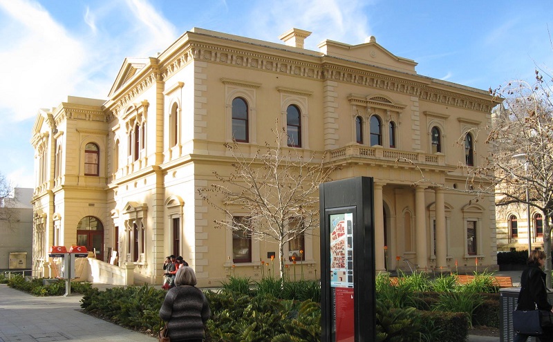
North Terrace is a street in Adelaide that also serves as one of the city’s cultural strongholds. Here are several museums and well-known buildings such as the governor’s residence Government House, the Old State Library, the Art Gallery of South Australia and the city’s beautiful railway station, Adelaide Railway Station.
Adelaide’s city center lies as a planned city within the four terrace streets, North Terrace, East Terrace, West Terrace and South Terrace. For the most part, there are parks and green spaces between the outer sides of these streets, thereby separating the center from Adelaide’s many suburbs.
You can take a lovely stroll along North Terrace, where you can, for example, start from Trinity Church from 1836 in the west and go east to the Adelaide Railway Station. Today the railway tracks are underground, but originally the tracks came from the west to the platforms. Now the Adelaide Convention Center and other buildings are erected on the old track sites.
On the way east you pass the Old Parliament House, which was the original parliament building for South Australia. Immediately after is the current parliament, the Parliament of South Australia, before crossing King William Road. Here is the Government House with a large garden in front of the house. The house is the official residence of the Governor of South Australia. On the following corner stands the National War Memorial from 1931.
After crossing Kintore Avenue, one can see the State Library of South Australia, the South Australian Museum and Art Gallery and South Australia, three of the city’s and state’s cultural flagships. This is followed by the University of Adelaide campus. Opposite the university is the Scots Church, which was consecrated in 1851.
You can continue east past the Ayers House mansion, completed in 1876, to the Adelaide Botanic Gardens, set in a large area of beautiful grounds. In the corner of the botanic garden, you can visit the National Wine Center of Australia, which is an exhibition building about the history of wine production in South Australia.
Victoria Square is the center of old Adelaide. The large square was named after Princess Victoria in 1837, and you can see a statue of Victoria in the square. Several of Adelaide’s well-known buildings are located around Victoria Square.
Victoria Square is one of the squares designed by the founder of Adelaide, Colonel William Light, who was the surveyor at the time. William Light’s 1837 town plan included the City of Adelaide, which spanned the Torrens River, thereby encompassing the city center and the North Adelaide area.
To the north you can see the towering General Post Office, built 1867-1872, which for many years was Adelaide’s main post office. To the east of the post office is South Australia’s former Treasury, which is now a hotel.
At the southern end of the square are several courthouses, which house the Supreme Court of South Australia, the Adelaide Magistrates’ Court and the Federal Court of Australia. On the eastern side of the square, you can see, among other things, the Catholic cathedral, the Cathedral Church of St Francis Xavier, which was inaugurated in neo-Gothic style in 1858.
In the middle of Victoria Square you can see two flagpoles where the Aboriginal flag flies next to the flag of Australia. Victoria Square is historic in relation to the flag, as it was here that it first went up in the country, which happened on 9 July 1971. Today, the square also bears an Aboriginal name, so Victoria Square is also called Tarntanyangga.
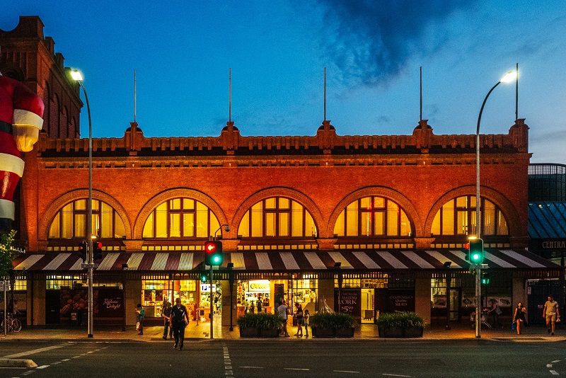
Adelaide Central Market is the name of the city’s large and popular food market, which offers cafes, restaurants and shops under the roofs of the halls. You can also simply take a walk here to enjoy the atmosphere in the old setting.
The market’s history began in 1869, when traders from a couple of Adelaide’s other markets moved to what was then called the City Market. The following year, the current market area was acquired for the purpose, and development continued thereafter.
Over the years, Adelaide Central Market expanded with many activities other than selling food, and this provided additional activity. There was, for example, darts, shooting and bowling, and a hotel and theater were also opened in connection with the market.
Trinity Church is a fine Anglican church, the oldest parts of which originate from South Australia’s oldest Anglican church. Founded in 1836, Trinity Church was one of the colony’s first churches. It was the businessman Pascoe St Leger Grenfell who donated the land for the construction of the church with an accompanying cemetery.
Originally, they wanted to build a prefabricated church from England, but it was destroyed on arrival in Adelaide, and therefore a stone church was built on the site instead. The church was formally dedicated in 1838, which was shortly after the founding of the city of Adelaide.
The church’s current appearance dates from the 1880s, when they chose to expand and rebuild the church. Parts of the church from 1836 were reused in architect Edward John Woods’ design. Woods used materials and colors that matched the former church.
Today, Trinity Church is located as a low building in the middle of modern Adelaide, and thereby it is a beautiful contrast that really shows the development of the city. In the church you can see, among other things, the William IV window that was brought to the city in 1836.
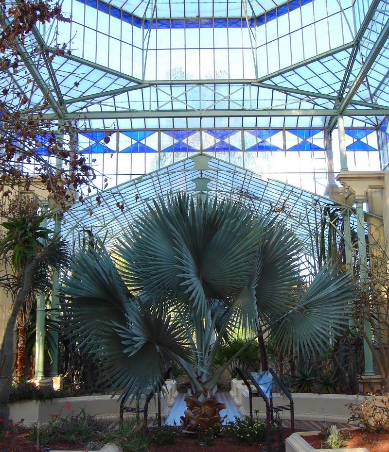
The Adelaide Botanic Garden is a botanical garden that is located as a beautiful oasis with many exciting plants and plants close to the city centre. The garden sits on a 51-hectare site that was laid out in William Light’s first town plan for Adelaide. It was laid out from 1855 and opened to the public in 1857.
You can take some lovely walks in the botanical garden today, and along the way you can see some beautiful buildings, not least of which is the garden’s Victorian palm house. The large greenhouse was designed by German Gustav Runge and imported from Bremen in 1875. You can also visit the Bicentennial Conservatory from 1989 and a beautiful rose garden.
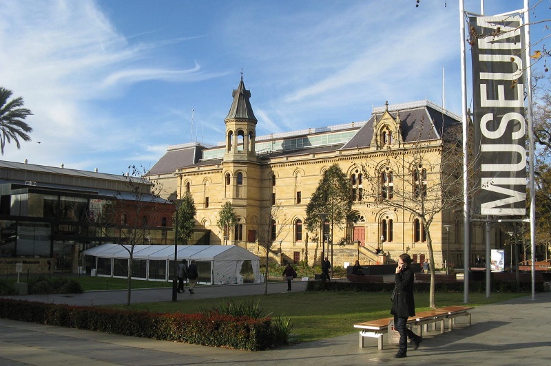
The South Australian Museum is a large and interesting natural history museum that was founded in 1856 and is located along North Terrace Street. Several times since then, the museum buildings have been expanded with new wings in line with larger collections.
The museum’s collections today number several million objects and specimens from large parts of the natural sciences. In the permanent exhibitions you can see, among other things, fossils, minerals, meteorites, opals, precious stones and much more. Over the years, the museum has also been known for the site’s fine collection of Aboriginal cultures.
Adelaide Zoo is the city’s zoo and the second oldest in Australia. Located close to Adelaide’s city centre, the garden is a major and popular asset in the city. The beautiful plants in the garden also function as a botanical garden.
In the garden you can, among other things, take a closer look at the fascinating Australian wildlife with, for example, kangaroo, koala, dingo, Tasmanian devil and wombat as some of the several hundred species that live in the garden. There are also special areas of focus such as Southeast Asia’s fauna.
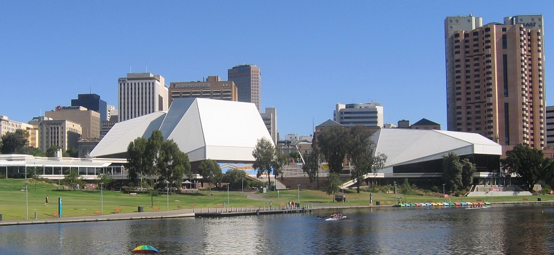
The Adelaide Festival Center is a large multi-arts center located along the banks of the River Torrens. Opened in 1973 and designed by Hassell Architects, the facility is characterized by two white geometric domed roofs.
The complex includes the Festival Theatre, Dunstan Playhouse, Space Theater and several galleries and exhibition spaces. There are also various outdoor facilities, and festivals and other major events are regularly organized in the area.
Parliament House is the parliament building of the state of South Australia. It is in a prominent location on the corner of North Terrace and King William Road. Parliament itself as an institution dates back to 1857, when South Australia gained self-government, and immediately west of Parliament House is its predecessor, which is today called Old Parliament House.
Old Parliament House was created by a major extension of the site’s original and very simple brick house.
The expansion took place with the help of the three important colonial architects William Bennett Hays; Edward Angus Hamilton and Edward John Woods. The old building still stands beautifully along the street as one of only a few buildings built before 1860 that remain in Adelaide.
Due to a lack of space, the current parliament building was built from 1874, but due to funding it was only completed in 1939. It was the architects Edmund Wright and Lloyd Taylor who designed the building, which has not yet received the intended dome and towers. The interior of the building is beautiful with, among other things, two meeting rooms.
Ayers House on North Terrace is a museum housed in the only surviving house in this area from Adelaide’s early years. The house was the home of politician Sir Henry Ayers from 1855-1897 and has been named after him after previously being called Austral House.
The plans for the mansion were developed in 1846 for William Paxton and it is believed to have been designed by George Strickland Kingston and built in local stone. When Ayers acquired the house, it had nine rooms, but the politician expanded the mansion considerably, and it was completed in 1876.
In the 1960s, there were advanced plans to demolish the beautiful mansion, but the building was saved, and it stands today as the last of the large 19th-century mansions along North Terrace Street. In the house, you can see the interior of the time in an exciting museum.
St Francis Xavier’s Cathedral is the name of Adelaide’s Roman Catholic cathedral. It was built in the years 1856-1858 and therefore stands as one of the city’s constructions from Adelaide’s early history. However, the 36 meter high tower is more recent, as it was built from 1887 and it took until 1996 before it was completed.
The history of the Catholic Church in the city predates St Francis Xavier’s Cathedral. The first Catholic mass was held in a house on East Terrace in 1840, and in 1845 a Catholic school was established to serve as a center for the congregation.
The cathedral has a beautiful interior with a lot of decoration. Here you can clearly see the architectural style, which is Neo-Gothic in the early English version. Among other things, you can see glass mosaics and a rose window, altars and several statues in the church room.
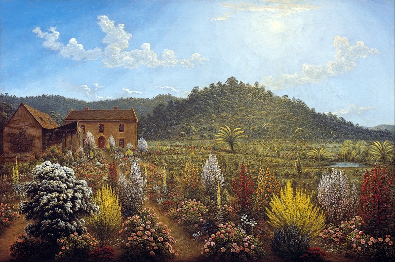
The Art Gallery of South Australia is the state art museum of South Australia, and it is one of Australia’s largest. The museum was established as the National Gallery of South Australia in 1881. The forerunner of the museum was the South Australian Society of Arts, which had been founded in 1856 and held annual exhibitions.
As a start, the museum bought 22 works of art in 1881, and since then the collections have expanded to tens of thousands of works, some of which are exhibited in the large museum. Among other things, you can see a large collection of Australian art here, which originates from both Aboriginal and colonial Australians. There is, for example, a fine collection from the so-called Heidelberg school.
The General Post Office is one of the distinctive buildings from the 19th century colonial era in the center of Adelaide. The original building was constructed in 1867-1872 as the city’s main post office, and the project was the most expensive structure built by the colonial government for South Australia.
It was Prince Alfred who laid the foundation stone for the post office, and coincidentally named the post office’s tower the Victoria Tower. The tower was built at a height of approximately 47 metres, and at the time it was a tall building, while the contrast with the city’s modern high-rises today is striking. The post office was in operation as the main post office until 2019.
Adelaide Railway Station is the city’s old main railway station, located in the northern part of the city center along North Terrace Street. Originally, the tracks came from the west to open platforms, but they are now laid below street level. Since then, the Adelaide Convention Center and other buildings have been erected on the old track sites.
Adelaide’s first railway station opened on the current station site in 1856. It happened in connection with the opening of the railway between Adelaide and the port city of Port Adelaide. Over the years, traffic and the rail network grew, and the station building became too small. The current Adelaide Railway Station was built 1926-1928 with a period grand interior.
Adelaide Town Hall is a building on King William Street in central Adelaide. The Town Hall was built as the town’s town hall according to designs by the architects Edmund Wright and Edward John Woods. Construction lasted from 1863 to 1866. The Town Hall Tower was built from 1864 and named after Prince Albert.
The building stands beautifully along King William Street and the interior is among the best examples of Victorian architecture in the South Australian city. In the building, there are several rooms such as the city council’s Council Chamber and The Queen Adelaide Room, which are used for larger receptions.
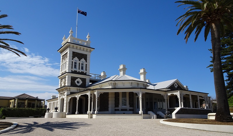
Glenelg is one of Adelaide’s western suburbs. However, the city was founded before Adelaide itself in 1836 and even as the first settlement on the mainland of South Australia. Today, Glenelg is a favorite excursion destination with the town’s lovely sandy beach, marina, fine buildings and relaxed atmosphere.
You can take a walk along the main street Jetty Road, where there are many shops and eateries. The street connects the town with the sea, and to the west it ends in the 215 meter long pier, Glenelg Jetty, which has been an attraction since the first pier in 1857. You can also walk a little north to the town’s marina.
Port Adelaide is located northwest of Adelaide as its port city. It was Adelaide’s founder, William Light, who in 1836 chose the site for the capital’s harbor town, and in 1837 the site was established as Port Creek Settlement. The settlement grew rapidly and was important as a transit point for the building of Adelaide itself.
Port Adelaide is today known for a number of preserved buildings from the 19th century and for the whole maritime atmosphere that prevails here. You can, for example, take walks along St Vincent Street and Commercial Road to get a closer look at the city. Among other things, you can see the Port Admiral Hotel from 1849 and The Railway Hotel from 1856, and interesting museums such as the South Australian Maritime Museum and the National Railway Museum are also located here.
Mount Lofty is the highest peak in Mount Lofty Ranges. The peak is 710 meters above sea level and is easily accessible. The scenery and views are impressive from the Mount Lofty Summit viewpoint, where you can see Adelaide and the surrounding area.
Mount Lofty was named by Matthew Flinders on 23 March 1802 during his circumnavigation of the Australian continent. In 1831, Collet Barker became the first European to climb the mountain, several years before the founding of Adelaide. Today you can enjoy the view and see the Flinders Column, which was erected in memory of Matthew Flinders.
Cleland Wildlife Park is a wildlife park located relatively close to the center of Adelaide, making it a popular place for excursions. The park is also located in beautiful nature in Cleland National Park with many wonderful hiking routes.
The animal park offers unforgettable experiences with the distinctive Australian wildlife. There are, for example, koalas and kangaroos among the park’s many animals, and you can also see Tasmanian devils, wombats, dingoes, possums and other fauna from Australia.
Rundle Mall/Grenfell Street
adelaidearcade.com.au
44-60 Gouger Street
adelaidecentralmarket.com.au
100 Rundle Mall
adelaidecentralplaza.com.au
447 Portrush Road
burnsidevillage.com.au
727 Tapleys Hill Road
West Beach
harbortownadelaide.com.au
Rundle Mall, King William Road, Rundle Street, Norwood Parade
Adelaide Zoo
Frome Road
adelaidezoo.com.au
Glenelg Beach
Glenelg
Cleland Wildlife Park
Mount Lofty Summit Rd
clelandwildlifepark.sa.gov.au
Mount Lofty Summit
Mount Lofty Summit Rd
parks.sa.gov.au
Mega Adventure Park
4 Hamra Avenue, West Beach
megaadventure.com.au
Adelaide Aquatic Center
Jeffcott Road, North Adelaide
adelaideaquaticcentre.com.au
The plains around present-day Adelaide were inhabited by Aboriginal Kauma tribes before Europeans came to Australia. Their territory went from Cape Jervis to Port Broughton on the map of our day.
The Aborigines named the place where Adelaide is today, for Tarndayna, who names a red male kangaroo cliff. It was believed to have been between 300 and 1,000 Aborigines in the area by the British arrival.
British Matthew Flinders and French Nicolas Baudin both sailed along the South Australian coasts in the early 1800s. Flinders named Mount Lofty in 1802, but none of the European expeditions sailed up what is the Port Adelaide River.
It was not until 1830 when Charles Sturt explored the Murray River that the knowledge of the Adelaide area was better described. Sturt noted that the plains looked advantageous for development, and that led to a more thorough expedition in 1831; initiated by New South Wales Governor Ralph Darling.
The expedition leader in 1831 was Captain Collet Barker. He was killed by Aborigines in the area, but despite this, the results of the investigations were an on-site recommendation as an area for a new colony.
Colonies in Australia had been established as camps for prisoners until the 1830s. This caused certain problems in the colonies, and in the late 1820s a group of people in Britain talked about a new way of building colonies; namely, by voluntary settlements.
Edward Gibbon Wakefield was behind the new ideas, and he proposed a system where settlers should buy land instead of getting it. The money from the land sale would then be used to transport skilled workers to the new colony to build it with people who were engaged rather than people sent to Australia as punishments.
Edward Wakefield’s secretary, Robert Gauger, propagated Wakefield’s thoughts and this led to the formation of the South Australian Association. In 1834, it was helped by The Duke of Wellington when the British Parliament passed The South Australian Colonization Act that enabled the new settlement. Wakefield would call the new colony Wellington, but King William IV preferred the queen’s name, Adelaide.
A commission was then set up to sell land for at least £ 3,500. Land was marketed and sold, and free transportation was promised for qualified people who would take work for others and save on the wages to buy land themselves and thereby hire new settlers.
The largest investor was The South Australian Company, led by slave owner George Fife Angas. The company bought enough land for the colony to be realized. When the legal requirements for sales were met, the king signed the documents for the new colony. It happened in 1836.
In February 1836, the ships John Pirie and Duke of York set out and headed for South Australia. In the following months, several ships arrived with more settlers. Most of the ships sailed to Kangaroo Island and our present-day Kingscote, where officials had to decide how the practical settlement should take place and be managed.
Surveyor William Light was given two months to find the most suitable place for the settlement. His job was to find an area of arable land, water resources, building materials, a possible harbor, etc. Kangaroo Island, Port Lincoln and Encounter Bay were places that did not live up to his requirements.
Most of the settlers were moved from Kangaroo Island to Holdfast Bay at present-day Glenelg, and on December 28, 1836, they were joined by Governor Hindmarsh, who could proclaim the start of the colonial rule in South Australia.
The newcomers were impatient to get started, and Light had to work quickly to find the right place for Adelaide. Port River was good as a port, but there was no fresh water. The River Torrens was then found, and William Light, upon closer examination, recommended a location along the river and between the harbor and the mountains of the area as the proper place.
Governor Hindmarsh believed that the settlement should be about three kilometers closer to the port than the Lights proposed site. After much discussion, the settlers voted on the two possible locations, and Light’s proposal won by the votes of 281 to 127. After that, the building of Adelaide could begin.
After deciding on the right place for Adelaide’s construction, William Light’s job changed to ensure the city’s best start and long-term development.
Light used the landscape topography to plan the city. For example, the Torrens Valley was laid out for parks and recreation areas, with plots in the city were located on higher land north and south of River Torrens. Adelaide itself was established at an area of 2.8 km²/1.1 sq mi located south of the river, while North Adelaide was laid out with an area of 1.38 km²/0.53 sq mi north of the river.
William Light also laid out an actual city plan for both Adelaide and North Adelaide. The town plan for Adelaide included perpendicular streets with Victoria Square as the central square and with the squares Hindmarsh, Hurtle, Light and Whitmore incorporated in the street network. In North Adelaide the square Wellington Square was laid out, and space was allocated for government buildings, a hospital, a botanical garden, etc.
On March 23, 1837, the first lots were distributed. Settlers who had bought land from home were allowed to choose first, and the remaining pieces were auctioned for prices from 2 to 14 guineas. A few weeks later, some plots of land were resold for between £ 80 and £ 100, which was a sign that the future was bright for Adelaide.
After leaving the town itself, William Light and his people were to begin the survey of agricultural land. George Kingston, as Light’s second-in-command, was sent to London to ask more people for the big task – and also to have Governor Hindmarsh recalled.
By the end of 1837, Light and his team had surveyed 243 km²/94 sq mi of agricultural land, and Adelaide’s population had risen to about 2,500. When George Kingston returned from London in June 1838, 605 km²/234 sq mi had been measured. However, Light did not get any more resources, and as a consequence, he quit his job. Hindmarsh was recalled, and on October 12, 1838, Geroge Gawler arrived as new governor.
The new colony in Adelaide suffered from a poor economy for the first time. When George Gawler took over as governor in October 1838, he came to a town largely devoid of public funding. Officials were underpaid, and about 4,000 immigrants lived in temporary housing.
Gawler was given a budget of up to £ 12,000 in annual expenses, with the addition of £ 5,000 which could be used in various emergencies. However, he had been sent to the colony with the assurance of a basic funding from the government.
At the same time, an agricultural economy began to take shape. The first sheep and other livestock were sailed to Adelaide from Tasmania, and since then sheep came overland from New South Wales. With the many sheep, wool production was established, which became the backbone of the colony’s economy in the early years.
Over the years, more and more farms were also established that cultivated the land. The grain farms were more expensive and took longer to establish than farms with sheep farming, but the economy was favorable, and in 1860 wheat was grown from Encounter Bay in the south to Clare Valley in the north.
In the town of Adelaide itself, the development was intended to center around Victoria Square and the extra-wide Grote Street and King William Street. However, developments were fastest in some of the city’s narrowest streets, Rundle Street and Hindley Street, as these were closest to the city’s water supply and Port Road, which was the access road to the city’s harbor.
Many public buildings were constructed. This included a governor’s residence, a police station, a prison, a hospital, a customs building and a new quay in Port Adelaide. However, the investments did not save the colony’s needy economy.
British investors had become interested in New Zealand and surveys showed that there was a limited area of good land available around Adelaide. The cost of living of the inhabitants also increased considerably around 1840, and increased public expenditure ended with a bankruptcy and change of the colony’s form of government.
As a result of the bankruptcy, the British Parliament approved a £ 155,000 loan to save the colony, which, despite poor economy, had become agriculturally self-sufficient and with a good infrastructure in a few years.
George Gray succeeded George Gawler as governor as a result of the colony’s poor economy. Gray cut public spending, and at the same time the 1840s were some good years for Adelaide with solid harvest results and ongoing finds of raw materials in the area.
Silver was first discovered at Glen Osmond in 1841, and the following year a copper deposit was found near Kapunda. In 1845, a major copper find was discovered at Burra, and it provided prosperity in the city and to those who had invested in the mineral extraction.
By the end of the decade, South Australia had become known as Australia’s entire food magazine, and the colony exported wheat, meat, wool, wine and fruit. When George Gray moved to New Zealand in 1845, the colony was buoyant and with good economy, which was a major change from the low point in 1842.
In 1851 gold was found in the colony of Victoria, and gold diggers and opportunists went to the gold fields to make money. It led to increased immigration to Victoria and many people from Adelaide moved from the city on the same occasion.
The relocation led to labor shortages, which weakened the economy and development. As a counterbalance to this, the demand for food, especially wheat, from Adelaide rose, so that gold money was indirectly earned here as well. After finding of gold or other earnings, many returned to Adelaide with money in their pocket, which was good on the town.
The population increased sharply in the colony, and politically South Australia gained the status of autonomous colony in 1857. At that time, approximately 110,000 people lived in South Australia, which introduced a two-chamber system with a seat in Adelaide.
Over the following decades, Adelaide evolved from growing a colonial city to becoming an actual metropolis based on European patterns. Thus, new institutions such as the city street lighting in 1867 and the University of Adelaide in 1874 were continuously founded and constructed. In 1881 the South Australian Art Gallery was established.
Meanwhile, South Australia had also become administrators of the Great Northern Territory, and during the exploration of the road to the north coast by John McDouall Stuart in 1862 new, large grazing lands were found at Lake Torrens and Lake Eyre. All of which helped to strengthen and expand Adelaide as one of the most important cities in Australia.
The 1890s were tough times for Australia, which was undergoing an economic depression. The tough years ended a chaotic growth and boom in land sales, and banks closed in Sydney and Melbourne. For Adelaide and South Australia, the years were less severe than for Victoria and New South Wales, although exports were almost halved. The colony was saved by not least the export of wine and copper, which was not significantly affected by the depression.
For Australia, the 20th century meant new times. Until then, Australia had been divided into six separate, self-governing colonies under Britain; New South Wales, Queensland, South Australia, Tasmania, Victoria and Western Australia. The colonies decided to form a federation, and on January 1, 1901, became the Commonwealth of Australia.
Adelaide’s town plan from the 1830s had proved long-term, and by the end of the 19th century most of the city’s many plots had been developed and built upon. In the year 1900, the city got electric street lights, and in 1909, the first of Adelaide’s electric trams ran the streets.
In addition to the trams, the Australian rail network was also being continuously expanded and the Federation Agreement between the Australian states included a federally funded runway between Perth in Western Australia and the Eastern States. Work on the track began in 1912 in Port Augusta, close to Adelaide.
World War I broke out in Europe in 1914, and many Australians participated in the war on the British side. From South Australia, there were 28,000 residents who volunteered for the war efforts and battles.
After the end of World War I in 1918, Adelaide experienced a boom, which was, however, interrupted by several years of drought, which produced poor harvest results and thereby reduced exports. The 1930s economic slowdown in much of the world also affected Adelaide and South Australia’s economy and development.
During World War II, Adelaide’s industries were expanded with large shipyards and other things, and it was during these years that Adelaide became a true industrial city. As during World War I, many volunteered for the war; this time around 70,000.
The decades after World War II brought new growth and new immigration. Between 1947 and 1973, 215,000 Europeans moved to South Australia, thereby gaining new skills and new labor.
The war industry was reshaped to produce electrical articles and Holden cars. A River Murray water pipeline was opened in 1955, and the same year, Adelaide Airport opened in West Beach.
In the remainder of the 20th century, Adelaide continued to grow, and new suburbs arose. New freeways were planned and rerouted, and the city’s trams were shut down in 1958 with only a single line left in operation.
It was also a period when art and culture flourished, and it was a deliberate effort by the board in the 1970s. The boom continued the following decades, with Adelaide hosting many events; for example, the Australian Formula 1 grand prix in the years 1985-1996.
Adelaide is a city where you can still see the city plan from the 1830s in the city scape, and you can follow the city’s history through the architecture and preserved buildings from Adelaide’s development from a small settlement to a modern metropolis.
Adelaide is also a city with many opportunities for tourists. The location means that there are both beaches and mountains close by, and in the city you can enjoy museums, various sights and activities and a relaxed atmosphere. Adelaide is also central to train travel to other parts of the country; both to Perth with the Indian Pacific and with The Ghan, driving via Alice Springs to Darwin on the Australian north coast.

Adelaide, Australia
Overview of Adelaide
Adelaide is the capital of the state of South Australia. It was founded in 1836 and named after Adelaide by Saxony-Meiningen, a British queen at the time. The city was laid out in a layout with perpendicular streets, wide boulevards and large squares. This can still be seen in central Adelaide.
Adelaide is Australia’s fifth largest city and it offers a number of attractions both in and around the city. In the center lies Victoria Square, which is surrounded by major institutions such as the state supreme court, federal court and city post office from the colonial era.
About the Whitehorse travel guide
Contents: Tours in the city + tours in the surrounding area
Published: Released soon
Author: Stig Albeck
Publisher: Vamados.com
Language: English
About the travel guide
The Whitehorse travel guide gives you an overview of the sights and activities of the Canadian city. Read about top sights and other sights, and get a tour guide with tour suggestions and detailed descriptions of all the city’s most important churches, monuments, mansions, museums, etc.
Whitehorse is waiting for you, and at vamados.com you can also find cheap flights and great deals on hotels for your trip. You just select your travel dates and then you get flight and accommodation suggestions in and around the city.
Read more about Whitehorse and Canada
Canada Travel Guide: https://vamados.com/canada
City tourism: https://visitwhite-horse.ca
Main Page: https://www.vamados.com/
Buy the travel guide
Click the “Add to Cart” button to purchase the travel guide. After that you will come to the payment, where you enter the purchase and payment information. Upon payment of the travel guide, you will immediately receive a receipt with a link to download your purchase. You can download the travel guide immediately or use the download link in the email later.
Use the travel guide
When you buy the travel guide to Whitehorse you get the book online so you can have it on your phone, tablet or computer – and of course you can choose to print it. Use the maps and tour suggestions and you will have a good and content-rich journey.


The South Australian Museum is a large and interesting natural history museum that was founded in 1856 and is located along North Terrace Street. Several times since then, the museum buildings have been expanded with new wings in line with larger collections.
The museum’s collections today number several million objects and specimens from large parts of the natural sciences. In the permanent exhibitions you can see, among other things, fossils, minerals, meteorites, opals, precious stones and much more. Over the years, the museum has also been known for the site’s fine collection of Aboriginal cultures.
Adelaide Zoo is the city’s zoo and the second oldest in Australia. Located close to Adelaide’s city centre, the garden is a major and popular asset in the city. The beautiful plants in the garden also function as a botanical garden.
In the garden you can, among other things, take a closer look at the fascinating Australian wildlife with, for example, kangaroo, koala, dingo, Tasmanian devil and wombat as some of the several hundred species that live in the garden. There are also special areas of focus such as Southeast Asia’s fauna.

The Adelaide Festival Center is a large multi-arts center located along the banks of the River Torrens. Opened in 1973 and designed by Hassell Architects, the facility is characterized by two white geometric domed roofs.
The complex includes the Festival Theatre, Dunstan Playhouse, Space Theater and several galleries and exhibition spaces. There are also various outdoor facilities, and festivals and other major events are regularly organized in the area.
Parliament House is the parliament building of the state of South Australia. It is in a prominent location on the corner of North Terrace and King William Road. Parliament itself as an institution dates back to 1857, when South Australia gained self-government, and immediately west of Parliament House is its predecessor, which is today called Old Parliament House.
Old Parliament House was created by a major extension of the site’s original and very simple brick house.
The expansion took place with the help of the three important colonial architects William Bennett Hays; Edward Angus Hamilton and Edward John Woods. The old building still stands beautifully along the street as one of only a few buildings built before 1860 that remain in Adelaide.
Due to a lack of space, the current parliament building was built from 1874, but due to funding it was only completed in 1939. It was the architects Edmund Wright and Lloyd Taylor who designed the building, which has not yet received the intended dome and towers. The interior of the building is beautiful with, among other things, two meeting rooms.
Ayers House on North Terrace is a museum housed in the only surviving house in this area from Adelaide’s early years. The house was the home of politician Sir Henry Ayers from 1855-1897 and has been named after him after previously being called Austral House.
The plans for the mansion were developed in 1846 for William Paxton and it is believed to have been designed by George Strickland Kingston and built in local stone. When Ayers acquired the house, it had nine rooms, but the politician expanded the mansion considerably, and it was completed in 1876.
In the 1960s, there were advanced plans to demolish the beautiful mansion, but the building was saved, and it stands today as the last of the large 19th-century mansions along North Terrace Street. In the house, you can see the interior of the time in an exciting museum.
St Francis Xavier’s Cathedral is the name of Adelaide’s Roman Catholic cathedral. It was built in the years 1856-1858 and therefore stands as one of the city’s constructions from Adelaide’s early history. However, the 36 meter high tower is more recent, as it was built from 1887 and it took until 1996 before it was completed.
The history of the Catholic Church in the city predates St Francis Xavier’s Cathedral. The first Catholic mass was held in a house on East Terrace in 1840, and in 1845 a Catholic school was established to serve as a center for the congregation.
The cathedral has a beautiful interior with a lot of decoration. Here you can clearly see the architectural style, which is Neo-Gothic in the early English version. Among other things, you can see glass mosaics and a rose window, altars and several statues in the church room.

The Art Gallery of South Australia is the state art museum of South Australia, and it is one of Australia’s largest. The museum was established as the National Gallery of South Australia in 1881. The forerunner of the museum was the South Australian Society of Arts, which had been founded in 1856 and held annual exhibitions.
As a start, the museum bought 22 works of art in 1881, and since then the collections have expanded to tens of thousands of works, some of which are exhibited in the large museum. Among other things, you can see a large collection of Australian art here, which originates from both Aboriginal and colonial Australians. There is, for example, a fine collection from the so-called Heidelberg school.
The General Post Office is one of the distinctive buildings from the 19th century colonial era in the center of Adelaide. The original building was constructed in 1867-1872 as the city’s main post office, and the project was the most expensive structure built by the colonial government for South Australia.
It was Prince Alfred who laid the foundation stone for the post office, and coincidentally named the post office’s tower the Victoria Tower. The tower was built at a height of approximately 47 metres, and at the time it was a tall building, while the contrast with the city’s modern high-rises today is striking. The post office was in operation as the main post office until 2019.
Adelaide Railway Station is the city’s old main railway station, located in the northern part of the city center along North Terrace Street. Originally, the tracks came from the west to open platforms, but they are now laid below street level. Since then, the Adelaide Convention Center and other buildings have been erected on the old track sites.
Adelaide’s first railway station opened on the current station site in 1856. It happened in connection with the opening of the railway between Adelaide and the port city of Port Adelaide. Over the years, traffic and the rail network grew, and the station building became too small. The current Adelaide Railway Station was built 1926-1928 with a period grand interior.
Adelaide Town Hall is a building on King William Street in central Adelaide. The Town Hall was built as the town’s town hall according to designs by the architects Edmund Wright and Edward John Woods. Construction lasted from 1863 to 1866. The Town Hall Tower was built from 1864 and named after Prince Albert.
The building stands beautifully along King William Street and the interior is among the best examples of Victorian architecture in the South Australian city. In the building, there are several rooms such as the city council’s Council Chamber and The Queen Adelaide Room, which are used for larger receptions.
Similar to Adelaide Travel Guide
