Quick search
CTRL+K
Quick search
CTRL+K

Yangon is a Burmese metropolis and one of the great cities of Southeast Asia when it comes to a great variety of architecture, an interesting culture and a delightful atmosphere. Sights are great as well, and accounts tell that the Shwedagon Pagoda stores relics of all four Buddhas of the present Buddhist Kalpa.
The city of Dagon emerged around the Shwedagon Pagoda, it later became Yangon and the British Rangoon from colonial times. This era is one that is particularly interesting in the center of Yangon, with one large and prestigious building after another from the late 1800s and early 1900s. Some of them are beautifully renovated, while others are nice to see with their many years of patina.
From the British colonial period, there are also lovely green squares, parks and lakes in Yangon, making the city’s favorite recreational areas today. A few examples are the city’s zoo and the areas around the artificial lakes north of the city center.
Myanmar became independent with the name of Burma in 1948, and since then Burmese culture has obviously left its mark on Yangon through traditions and activities at the beautiful Buddhist temples and pagodas, of which Shwedagon is the largest and best known. In fact, Shwedagon is unique to the world and number one sight to see in the city.
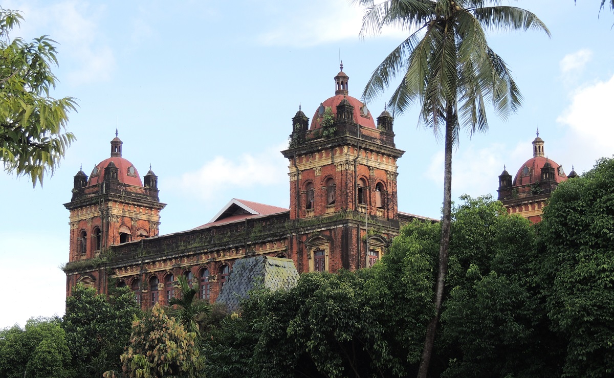
The Secretariat Building is a large building complex from the Victorian era. The foundation stone was laid in 1889, and the extremely large complex was completed in 1905 according to the architect Henry Hoyne-Fox’s drawings. After the British conquest of Upper Burma in 1886, the building was to replace the then Secretariat Building, which was located on Strand Road. With Upper Burma, the need for building space for the British administration increased, and thereby the new Secretariat Building gained its colossal size by the conditions of the time.
The southern wing of the Secretariat Building was completed in 1893. The eastern and western wings were constructed 1903-1905. When completed, there were small towers all around the wings of the building, and there was a central dome. The dome and most of the towers were destroyed during the earthquake that hit Yangon in 1930.
The building was called the Secretariat Building in British times, and it was here that the Union Jack was flown for the last time in the colony. It happened to the tune of God Save the King, and then the flag of independent Burma was raised. Subsequently, the Secretariat Building was known as the Ministers’ Office.
The Secretariat Building housed the country’s parliament in the years 1948-1962, and it was also here that the politician Aung San was assassinated in 1947. It happened on July 19 during a meeting in the south-western part of the complex. This room has always been maintained as a monument to the slain general and independence leader.
Since the move of Parliament, the building has been unused and without access, and over the years this gave the Secretariat Building an increasingly dilapidated exterior, where bushes and plants began to grow. Doors and windows broke, and altogether one of the city’s largest buildings became a partial ruin.
In 2012, permission was given for a large-scale restoration and redecoration project, in which it is planned to turn the former parliament into a large cultural site with museums, galleries and space for various cultural events. The site of the assassination of General Aung San is naturally one of the historically central spaces thought of as part of a museum.
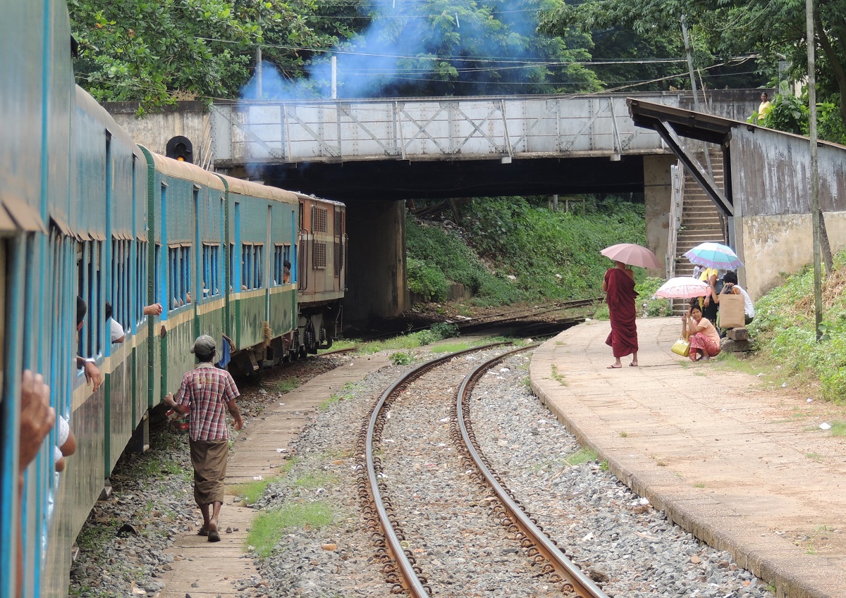
The Yangon Circular Railway is an S train that runs in an oval in the districts and suburbs north of central Yangon. You can try a trip with the track from, for example, Yangon’s main railway station, and the round trip with the track is an S-train, which runs in an oval in the districts and suburbs north of central Yangon. A round trip takes about three hours to get around to the 40 or so stations along the way. The track was built during the British era and is a great opportunity to get a tour with a view of the Burmese metropolis.
If you want to experience a trip with the track, but don’t have time for the whole round trip, you can advantageously drive a shorter section. This can be done, for example, from Phaya Lan station, which is located immediately behind and north of Bogyoke Market, which many tourists probably also visit in Yangon. From here you can drive west and north to the Kyeemyindaing station, which is one of the track’s major stops. Here you can see a beautiful railway station building from the colonial era, and it emphasizes the large facility that the ring railway was in its time.
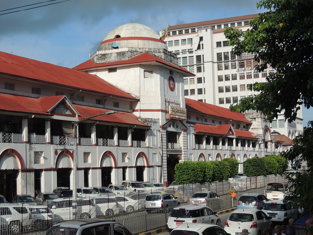
Bogyoke Aung San Market is a must for many visitors to Yangon. It is a covered market where you can buy a wide variety of things such as clothes, jewellery, souvenirs, coins, gemstones and art. All you have to do is explore the inner cobbled streets.
The market was built during the British era and opened in 1926, so you can also enjoy the colonial architecture during a visit. The market was originally called Scott’s Market, and it was named after Gavin Scott, who was a leading official in the British administration of Rangoon at the time.
Today, there are also quite a few stalls and shops in the streets around the market. Along Bogyoke Road there is, for example, a fruit and vegetable market, and opposite the market building itself there are several side streets with, among other things, supermarkets and a number of eateries.
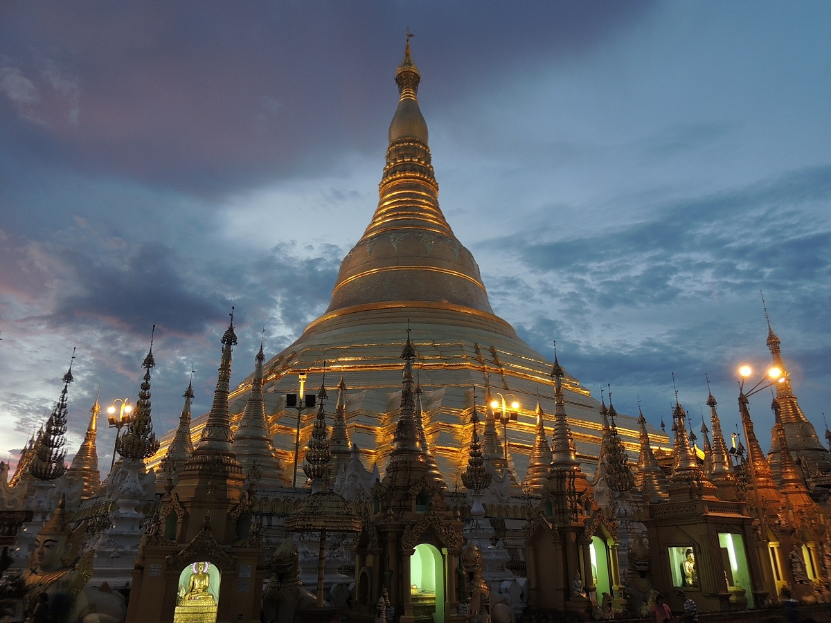
Shwedagon is Yangon’s landmark and the holiest Buddhist site in Myanmar. The pagoda consists of a golden stupa with an impressive height of 99 meters and is said to contain the relics of four Buddhas.
There are a total of 29 named Buddhas in Buddhism, five of which belong to the current time period; the so-called kalpa. In Shwedagon there are relics of Kakusandha Buddha who is the first Buddha of the current kalpa named bhadrakalpa. The other three Buddhas in Shwedagon are the following three in bhadrakalpa; Konāgamana Buddha, Kassapa Buddha and Gautama Buddha. Gautama Buddha is the present Buddha and the fifth and last Buddha in the bhadrakalpa is Maitreya Buddha as the future Buddha.
According to tradition, Shwedagon Pagoda was built over 2,500 years ago, while historians and archaeologists point to the period 500-900 as the time of the beautiful construction. The legend of the tradition says that two brothers from what is now Afghanistan met Gautama Buddha and received eight hairs from him. The brothers traveled to Burmese territory under King Okkalapa, where they came to the mound of Singuttara, which was already home to relics of previous Buddhas. When King Okkalapa opened the hairs on the spot, miracles are said to have occurred in the form of Mount Meru shaking, light spreading, the deaf hearing, the mute speaking, the blind seeing, fruit falling on trees, and precious stones raining.
Shwedagon Pagoda was not 99 meters high from the beginning, and until the 14th century the shrine decayed with time. Here, King Binnya U restored the site and increased the height to 18 meters. In the 15th century, Queen Shin Sawbu expanded the facility, and the gilded Shwedagon reached 40 meters in that connection. In 1768, an earthquake destroyed the top of the pagoda, and subsequently King Hsinbyushin restored and expanded the Shwedagon, whose height the king increased to the current 99 meters.
You can see many design elements at Shwedagon, which in terms of construction is made of brick with real gilding on the outside. At the bottom are a number of terraces to which only monks and men have access. Above this, in ascending order, the bell-shaped part of the stupa, a turban, an inverted alms bowl, upright lotus petals, a banana shoot and the umbrella crown worn by all pagodas in Myanmar. This crown is set with 5,448 diamonds and 2,317 rubies. Above the umbrella crown is a sash and at the very top is a diamond knob with a 76-carat diamond.
The lavish and genuine gilding is a result of ongoing donations of gold that continue to this day. The tradition started in the 15th century with Queen Shin Sawbu, who donated her own weight in gold to the Shwedagon.
There are four entrances to the Shwedagon, and at each of these stand a pair of leogriffs and guardians; they are lion-like creatures, also called chinters, which are often seen at the entrance to pagodas and temples in Myanmar. Going clockwise around Buddhist stupas, a start from east to south, west and north is chronologically correct, passing here the relics of the four Buddhas from the first to the fourth of the bhadrakalpa in that order.
The Shwedagon itself is built on an octagonal foundation, representing eight planets in Burmese astrology. Most people in the country are Theravada Buddhists, in which nine planets are counted; The Sun, Moon, Mercury, Venus, Mars, Jupiter, Saturn, Rahu and Ketu. Ketu is the king of the planets, while the other eight form zodiac signs in relation to which day one was born. The days are named after the eight planets in Burmese, and to accommodate all eight, Wednesday evening is set aside as a separate day. Each day has an animal and an image of the Buddha, and these eight are on each edge of the Shwedagon’s foundation. Thereby, Buddhists can come to their exact place in astrology, lay flowers and prayer flags, pour water and say a prayer. One can therefore see many pilgrims coming here and performing these rituals.
Over time, Shwedagon has been the subject of several political fights. The British repeatedly used the pagoda as a fortification during their time in Burma, and for many years the British did not remove their shoes before entering the pagoda, which was contrary to tradition and so significant that it became the subject of popular protests. In 1919, the English had to introduce legislation that one had to take off one’s shoes when visiting.
In 1920, students from Rangoon University planned a protest meeting at the southwest corner of Shwedagon. It was a counter move to a new university law, which they believed was too elitist and beneficial to the British colonial power. The protest led to the establishment of several Burmese schools, and the episode is part of Myanmar’s national days. Among other political meetings was General Aung San’s demand for independence, which he demanded in front of a crowd from Shwedagon in 1946.
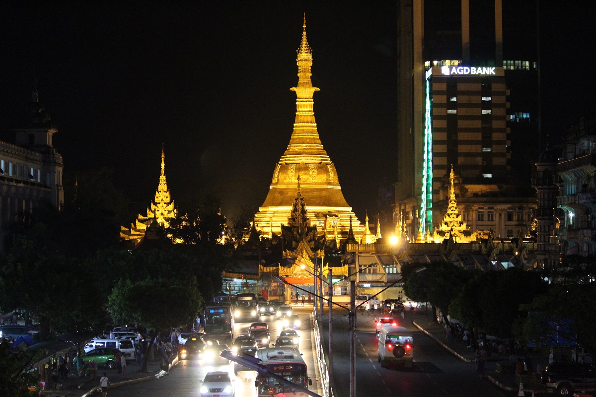
Sule Pagoda is a Burmese stupa believed to date back more than 2,500 years. It is located as the center of Yangon and is therefore also very visible with its place in the middle of the right-angled city plan to the south, where the institutions and trading houses of the colonial era shot up. With this location, the stupa has been the site of political meetings and popular uprisings several times.
The form of the stupa goes back to the recreation of a sacred mountain, and the Sula Pagoda is an example of the Burmese development of the appearance, which differs from, for example, some constructions in India. Sule Pagoda is also particularly sacred, as it is said to have been built around hair from the Buddha, which two Burmese merchants were supposed to have brought home from the Buddha himself.
The Sula Pagoda was built on the site where legend has it that the spirit Sularata once had his home. Sularata was one of the so-called nats, which were various spirits in the Buddhist world. According to legend, kings would build a shrine on the spot around Buddha’s hair, but this was so long ago that the spirit had to help pinpoint the exact spot where the relics were buried.
Alexander Fraser, who was in the Bengal Corps of Engineers, chose the same site as the center of the town plan he designed for the development of Yangon shortly after the British conquest of the area in the mid-1800s.
The central part of the stupa is the high chedi, pagoda, which got its current appearance under Queen Shin Sawbu in the 15th century. The other parts are newer and laid out in beautiful harmony with the old part of the facility. The height of the gold-plated chedi reaches 44 meters.
The High Court stands as one of the most beautiful and grandly constructed buildings of the colonial period in Yangon. The red and white brick building was designed by the architect John Ransome and erected in 1905-1914 as the highest court in the British administration of the colony. At the time it was called Parliament for Justice, and in 1962 the Burmese government turned the place into the Supreme Court.
The external characteristics of the building are the artistic use of the bricks in the decoration and the bell tower. The High Court Building was built as the archetype of British colonial architecture in a grand and imposing style as a symbol of British supremacy.
It is planned to transform the High Court Building into a large new museum and cultural center for local theater art and history, of which the beautiful puppet theater is a part. This opportunity arose with the move of Myanmar’s capital from Yangon to Naypyidaw; in this connection, the country’s supreme court was moved to a new building here in 2006.
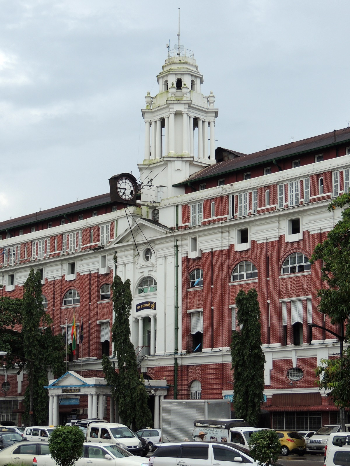
The large customs building, Customs House, is one of Yangon’s largest and most elegantly located buildings from the English colonial era. The red and white brick building was built in 1915 as a customs house for goods shipped to Rangoon and Burma by river.
The architect was John Begg, who was also behind Rangoon’s Telegraph Office. As a striking feature of the Customs House’s facade, he designed the white tower, on which there is a clock facing the street.
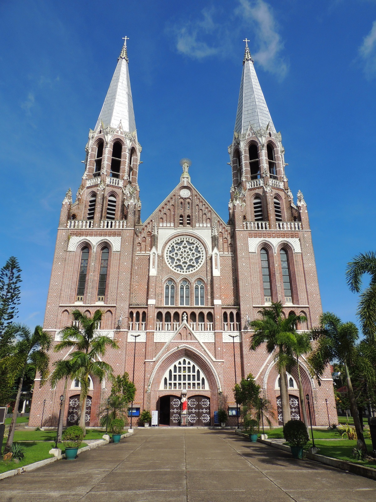
Saint Mary’s Cathedral is a Catholic cathedral that was built as Burma’s largest church in the years 1895-1899. The design of the red brick church was carried out by the Dutchman Jos Cuypers. The church still stands today as originally; however, the first glass mosaics were lost in connection with the Allied invasion of Rangoon after Japanese occupation during World War II.
Before the construction of Saint Mary’s Cathedral, there was a smaller Catholic church in the town, which Bishop Paul Bigandet eventually judged to be too small for the ever-larger congregation. He applied to the colonial administration to sell a large enough piece of land at Saint Paul’s High School so that a prominent church could be built in the best materials and design.
After construction began, a later bishop made the church larger than originally planned, and thereby Paul Bigandet’s thoughts materialized in the current cathedral, which measures 89 meters in length and 31 meters in width in the ground plan. Inside you can see a beautifully decorated church room with classy use of bricks for the decorative elements. It is thus both a large, beautiful and characteristic church space, which you are greeted by behind the two-towered facade.
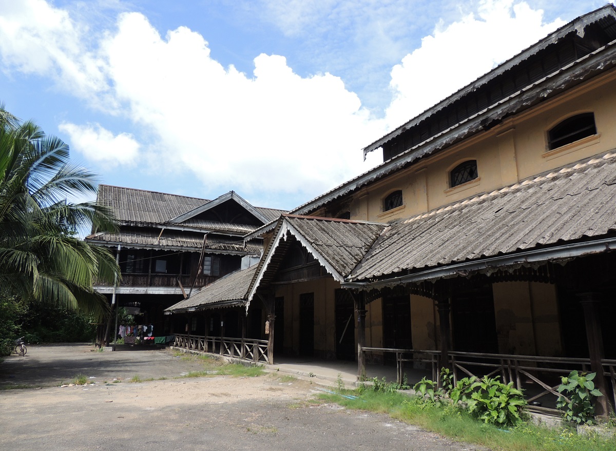
During the 19th century British colonial times, there were clubs for senior military personnel and officials in the colonies, and this was also the case in Rangoon and Burma. Opened in 1882 as a gentlemen’s club in the style of the Royal Selangor Club in Kuala Lumpur, the Pegu Club quickly became one of the most famous of the British clubs in Southeast Asia.
The Pegu Club building itself is a beautiful Victorian-style house with Burmese inspiration. Visitors here had upscale conditions until the club closed and the house fell into disrepair over many years.
Pegu Club is today known for the drink of the same name. It is a gin-based cocktail, and it was the signature drink of the Pegu Club, and from the 1930s it appeared in international cocktail books. Incidentally, Pegu is the name of a river in Myanmar.
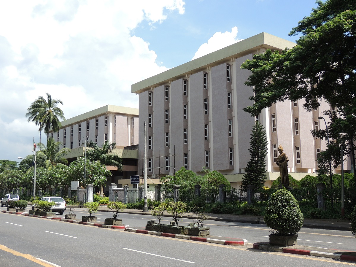
This is Myanmar’s National Museum of History, Art and Culture, and there is a lot to look at. From early times, fossils and petroglyphs from the Stone Age are here, while there are many beautiful and interesting finds from the times after that. Culturally, through the exhibition you get an insight into many parts of the country’s history, such as royal ceremonies and effects in connection with it.
The museum was founded in 1952, which was a relatively short time after the country’s independence in 1948. The institution opened its doors in the current museum complex in 1996.
The Governor’s Residence was built in 1920 as a beautiful house in teak wood to be the private residence of the British governors of the colony of Burma. As a result, for example Sir Reginald Dorman-Smith and Hubert Rance came to live here before Burma gained its independence in 1948. The house still stands beautifully today in its Victorian style, and since 2006 it has been used as a hotel. In this way, the hotel is a good place to experience some of the buzz from the British colonial era up close.
The Governor’s Residence should not be confused with the now historic Government House, which was built in the palatial Queen Anne style in the years 1892-1895 according to Henry Hoyne-Fox’s designs. Government House was the official residence of the head of the colony, who in the colonial years had various titles such as governor. Government House was later called the President’s House during Burmese independence, and the country’s leaders lived here until the house was destroyed by an earthquake in the 1970s. It was demolished in 1985.
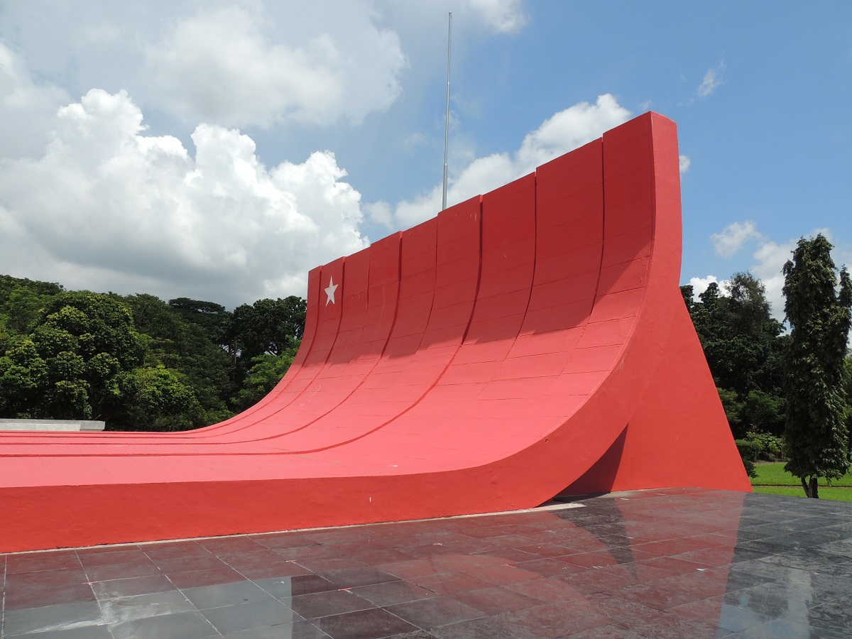
On July 19, 1947, General Aung San was shot dead by a political rival. Eight other Aung San supporters were also killed in the incident, which took place in the last year of British colonial rule in Burma.
Aung San had already in January 1946 demanded independence for Burma and thereby an end to British colonial rule. He and the eight others who died on this day thus became prominent victims of the country’s struggle for independence.
A mausoleum was built for Aung San and the other victims after Burma’s independence, which became a reality on January 4, 1948. The mausoleum was destroyed in 1983, when a bomb attack destroyed the site. The mausoleum was rebuilt and today it stands in red with a white star on it.
Immediately northeast of the Martyrs’ Mausoleum can be seen a memorial generally dedicated to Myanmar’s fallen heroes; Memorial to Fallen Heroes.
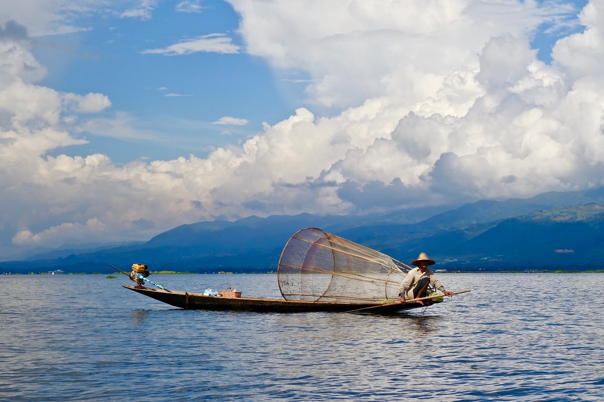
Inle Lake is a lake of just over 100 km2. The lake is one of the largest in Myanmar, and it is located at an altitude of 880 meters. With a maximum depth of 3-5 metres, the lake is quite shallow, and this provides good conditions for the rich life that is on and around the lake.
In addition to its natural beauty, Inle Lake is known for the cultures and villages that live and lie around and also on the lake. Life on the lake consists of actual villages built on stilts, and in these villages there are both homes, schools and other things that you associate with small urban communities. There is also fishing, agriculture and a number of handicrafts, which include weaving and the production of special cigars.
The villages on the lake are an experience with their many canals, main streets and side streets, where boats sail through and around from place to place. You can, for example, sail to a shop or restaurant. Between some of the houses and quarters in the various villages there are also footbridges over the canals, so that the inhabitants can go from place to place; however, this is only possible over limited distances.
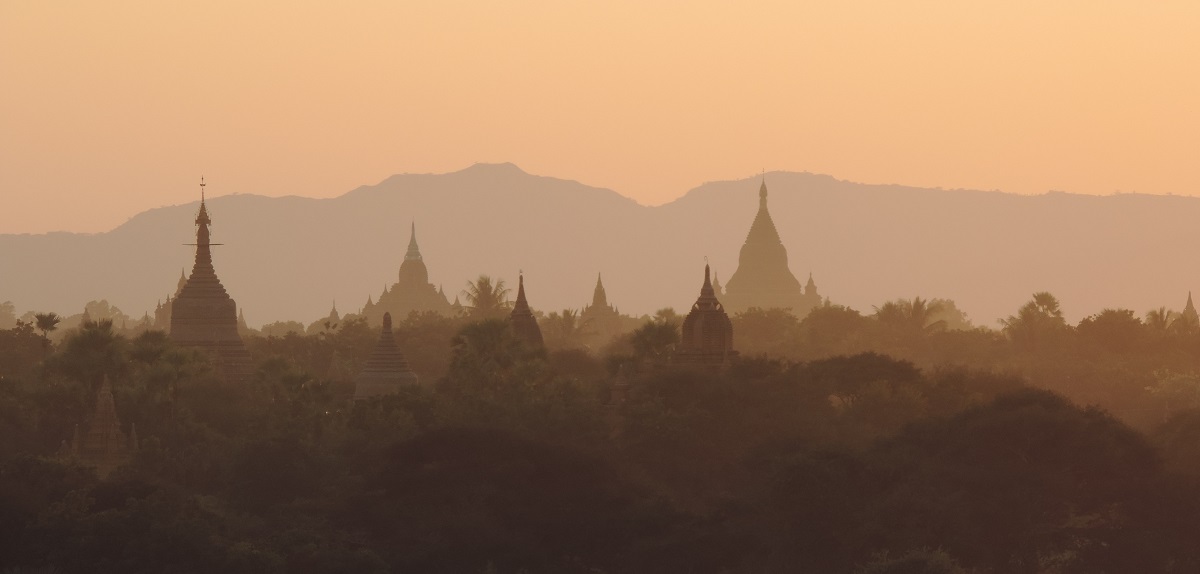
Bagan is one of Myanmar’s former capitals; and under the name of Pagan it was the center of the empire of the same name from 1044 to 1287, when it was destroyed by the Mongols. Today, Bagan is famous for its countless ancient temples and other religious buildings spread over a large area of the historic capital.
As the center of the kingdom and the region for almost 250 years, Bagan was the political and economic focal point. It brought prosperity, which was used, among other things, to build more than 10,000 larger or smaller buildings of a religious nature. It happened in an area of over 100 square kilometers.
Bagan’s decline started in the 13th century, and from the 1280s, Mongol troops were decisive for the city’s final end as a center of power. In its heyday, up to 200,000 inhabitants are believed to have lived in Bagan, but despite being the formal capital until the year 1297, the city had already been reduced to a smaller and, compared to earlier, insignificant city.
Throughout the centuries since the collapse of the Pagan kingdom, new temples have been built in Bagan; mostly through the 1300s and 1500s, but also quite a bit since then. Today, more than 2,000 different buildings have been preserved, the largest and most important of which are from Bagan’s heyday from the 1000s to the 1300s. Part of has been restored from the end of the 1990s, as destruction due to earthquakes among other things had destroyed parts of many of the temples. The most important temples are located around the so-called old Bagan, which has its center a few kilometers north of the city of New Bagan, where the inhabitants of the archaeological area were moved to in order to protect the large temple landscape.
Basically, two kinds of fundamentally different temples were built in Bagan; partly massive constructions of the stupa type with a reliquary room inside and partly buildings with actual rooms inside, which are the so-called cave temples. Both parts can be seen today during a visit to Bagan, and in that way you can also see early developments within Burmese architecture.
Amarapura is a city beautifully situated on the course of the Irrawaddy River south of Mandalay. Amarapura is known to have been the Burmese capital during two periods; 1783-1821 and 1842-1859. As early as 1857, King Mindon established Amarapura’s successor in the form of Mandalay to the northeast, and in 1859 his palace in the new city was completed. After this, the capital moved to Mandalay, which Amarapura administratively falls under today.
Amarapura was founded by King Bodawpaya in 1783 and today it has grown to be a major suburb of Mandalay. In Amarapura, you can still see remains of the facilities from the time as the capital and also the famous bridge, U Bein Bridge, which attracts many tourists who visit the area of Myanmar’s two former capitals.
Amarapura Palace/Amarapura Palace was a royal palace built in the decades around the year 1800; a time when the city was the Burmese capital and thus required a royal residence. The end of the palace came with King Mindon’s accession to the throne in 1857, when he moved the capital to Mandalay. In this connection, he reused the parts from the palace in Amarapura in his new capital. Today, only a few remains of the extensive historic palace can be seen. Part of the palace’s moat is still here, and you can also take a closer look at the tombs of King Bodawpaya and King Bagyidaw.
U Bein Bridge is Amarapura’s best-known attraction. It is a bridge that crosses Taungthaman Lake. The bridge was built from teak wood in the years 1849-1851, and it has an impressive length of 1.2 kilometers. The wood came from a now former palace in Inwa, and the reuse of wooden structures was not unusual in the era; for example, Amarapura’s royal palace was reused in Mandalay.
The bridge consists of 1,086 stilts in the water with planks on top. The majority of the bridge is in the original wood, but over time it has been necessary to replace some parts. Four pavilions have been built along the bridge, and there are nine places along the way where the bridge can be lifted so that boats can pass. The name U Bein Bridge comes from the mayor who had the bridge built.
You can experience a lot of traffic on and off the bridge. It concerns both tourists and local visitors, some of whom cross the lake using the bridge. There is also fishing in the lake, which is often done standing on the lake bed.
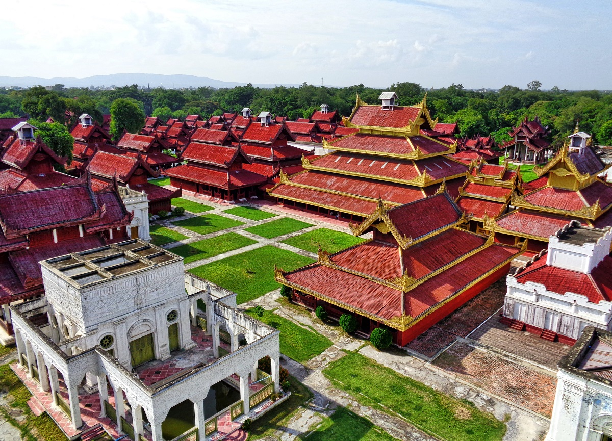
Mandalay is the largest city in Myanmar after Yangon. Its history dates back to 1857, when King Mindon founded Mandalay as the new Burmese capital, replacing nearby Amarapura. It happened in accordance with a tradition in which the Buddha was supposed to have visited the mountain Mandalay Hill and predicted a new capital at the foot of the mountain in the year 1857.
Mandalay is the latest city to have been a royal residence in the country. That status stopped with England’s conquest of the area in 1885. Today, Mandalay is a city of millions with several attractions, not least of which go back to the time as the country’s capital.
Bogyoke Road
Kyun Taw Road
380 Bogyoke Road
Bogyoke Road
Maha Bandula Park, Maha Bandula Park Street, Sule Pagoda Street
Maha Bandula Park
Maha Bandula Park Street, Sule Pagoda Street
View Point
Shukhinthar Mayopat Road
Yangon Ring Railway
Kun Chan Road
Yangon Zoo
Kan Yeik Tha Road
Founded Yangon’s story begins in time with the name Dagon, which the Mon people of Lower Burma founded in the 1000s. At that time, Dagon was a smaller fishing village that lay around the religiously important Shwedagon pagoda, whose size at that time was somewhat smaller than it is today.
Dagon was for many centuries a fishing village whose location was strategically good at the confluence of the rivers Pegu and Myitmaka. In addition, the Shwedagon Pagoda, which over time became an increasingly pilgrimage target with the accompanying activity as a side benefit to Dagon.
The Konbaung Dynasty was founded by King Alaungpaya, who ruled 1752-1760. He is considered one of the great Burmese kings in history, which is not least due to the fact that for the third time through time he gathered the Burmese territory into a kingdom.
Alaungpaya was also the king, so to speak, founded Yangon. During his reunion of the land, he also conquered Dagon, and after that event he named the city of Yangon.
In 1824-1826, the first Anglo-Burmese war was fought, between British colonial troops and Burmese armies. Yangon was captured by the English, but after the end of the war it was returned to the Burmese. The Battle of Yangon had been going on from May to September 1824, when about 10,000 men from the British Navy had attacked from the river side. The Burmese retreated, leaving an empty city where the British entrenched themselves in the Shwedagon pagoda.
The Burmese king gathered 30,000 soldiers outside Yangon to fight back the numerically weak Englishmen. The Burmese troops were, however, materially inferior, and the British were able, by force of arms, to maintain a position against the attacking Burmese. The British used, among other things, Congreve rockets, which had been used for the first time during the British terrorist bombing of Copenhagen in 1807. It was a weapon unknown to the Burmese.
The war had revolved around the rule of the Northeast Indian Territory and the result was a great British victory, which meant that Burma had to pay compensation to the English as well as allow a trade agreement that increased British influence in Burmese. Formally, the war ended with the conclusion of the Yandabo Treaty, which was signed in Yandabo; just 80 kilometers from the then Burmese capital of Ava.
For the English, however, the war had been so expensive that it caused economic crisis in British India. However, the first Anglo-Burmese war was not to be the only one in the 19th century. In total, three became the kind that gradually secured British colonial rule in Burma.
After a few decades without war, a new war broke out between the English and the Burmese. In 1852, the British provoked a confrontation, so there was a cause for the war that began on April 5, 1852. They had, among other things, blocked Yangon’s port and seized the Burmese king’s boat. On April 5, the port of Martaban was taken and just a week later British forces captured Yangon.
Two days later they conquered the Shwedagon Pagoda, where they had also entrenched themselves during the war of the 1820s. The Burmese had to retreat to the north and the Yangon and Pegu regions were annexed by Britain as a colony.
The Second Anglo-Burmese War ended without formal peace. For the Burmese, the war meant that Pegu was lost to the king, proclaiming this part of Burma British on January 20, 1853. With the lost war, it also revolted against King Pagan Min, ruled by Mindon Min, who subsequently moved the capital of Mandalay.
For Yangon, the new status of British colonial rule meant a greatly increased British influence, with trading companies pushing around, for example, teak and shipping. New societal structures and institutions based on British pattern and role model also influenced the cityscape, thus creating the foundation for the colonial era’s preserved Rangoon.
Among the things that happened in Rangoon in the following years were the establishment of the port authorities in the Port of Rangoon, the publication of the Rangoon Chronicle newspaper, the establishment of schools such as St Paul’s English High School and the coming of the railway in 1877. The population has increased over the decades from around 30,000 at the first Anglo-Burmese war in the 1820s to over 130,000 in the early 1880s.
It was also during this time that Yangon’s urban plan was designed by A. Fraser. The plan became a rectilinear grid of streets with Sule Pagoda as the center. Sule Pagoda Road went north-south, while Dalhousie Road / Maha Bandula Road went east-west. Between the parallel streets of Dalhousie Road, Strand Road, Merchant Road / Konthe Road, Canal Street / Anawratha Road and Commissioner’s Road / Bogyoke Aung San Road, the city’s new administration center was constructed.
By 1853, Yangon and Pegu had become British with the names Rangoon and Lower Burma. Back in independent Burma was Upper Burma, where the Konbaung dynasty ruled for the Third Anglo-Burmese War, which took place on 7-29. November 1885.
Diplomatic relations had been severed between Great Britain and Burma in 1878, and the French had conquered Indochina and entered into cooperation agreements with Burma. These things were factors that led the British to truly declare Burma’s war through the establishment of an ultimatum that could not be accepted by King Thibaw and the government of Mandalay.
The result of the war was the conquest of Mandalay and the deposition of the Burmese monarch. Independent Burma, along with the previously conquered parts of the country, became subject to the British as a province of British Raj in India.
Rangoon saw increased growth in the last decades of the 19th century, with population continuing to rise rapidly, with the city also growing. With the population, new churches and schools were built, and in general it was a new one with a lot of new construction and good conditions for the British belfry.
The local elite also had access to, for example, the elitist education system where the language was English. The University of Rangoon was the only country, and from this originated both British graduates and locals, who, for one, came to influence Burmese political development from the country’s independence in 1948.
In the year 1900, more than 200,000 lived in Rangoon, and trade grew continuously. In those years, many of the city’s famous colonial buildings were erected, such as the prestigious Strand Hotel and the Secretariat Building as the political center of power.
In 1937, Rangoon became the capital of British Burma, which, after being governed as a province of India, became an independent province. At this time, Rangoon was planning according to British model in his city plan with large parks and upscale residence along the artificial lakes of Kandawgyi Lake and Inya Lake. However, the population was quite mixed and over 50% of the 1930s half a million inhabitants were from India or from southern Asia. Only about a third were Burmese.
In 1920, 1936 and 1938, Yangon became a scene of rebellion in connection with the Burmese wanted independence from Britain. The rebels were overcome by the British, but World War II changed the country significantly. Japan invaded and conquered Burma in 1942, and the war resulted in bombardment of the city; For example, the British sought to destroy the port facilities in the city. Japan’s occupation of the city and the country lasted until 1945, when British colonial rule continued.
After the end of World War II, there was a continuing demand for independence from Britain, and one of the front fighters was General Aung San, who in 1946 became Burmese leader under British rule. Aung San held a political seat in Yangon’s Secretariat Building, and in 1947 he led the successful negotiations with the English for Burma’s independence, which became a reality on January 4, 1948. Before that, however, Aung San was shot by a political rival on July 19, 1947. It happened in the Secretariat Building, so Aung San did not come to experience the freedom he had fought for.
In the new Burmese union, changes were rapidly made in relation to British times. Highly visible, many of Yangon’s street names were changed from British to Burmese; this was the case, for example, of Dalhousie Road, which became Maha Bandula Road. Symbolically, the street name went from paying tribute to a British who had contributed to the Anglo-Burmese wars, to a remembrance of General Maha Bandula, who, as Burmese, fell during the first of the three 19th century wars against the British.
In the first decades after Burma’s independence, the country’s governments expanded the capital, which was still called Rangoon. New suburbs were built and the city spread rapidly from the old British center to the south in today’s metropolis.
On the whole, it was expanded at the same time as the buildings of the former colonial period were decaying. Infrastructure and building stock were not sufficiently maintained throughout the 1960s to 1980s, but during the same period, the buildings were not sanitized, which is why Yangon contains a number of British buildings that many other colonial capitals cannot show in the same volume and quality.
In 1989, Rangoon’s name was officially changed to Yangon, and later the country changed its name from Burma to Myanmar. In 2005, the capital moved to Naypyidaw in central Myanmar, and as a result, Yangon was no longer the country’s capital with the many political institutions that come with this status.
However, Yangon remains clearly Myanmar’s largest city, and growth has been steady in recent decades. In 1983, the figure had reached 2,500,000 inhabitants, while the population had almost doubled thirty years later. The large growth, which has also been economic in recent years, has its mark on the street scene. Old buildings from the colonial period have to some extent been downgraded in favor of taller and more modern buildings. This development started in the 1990s, when Yangon designated hundreds of buildings with a status of conservationists. Today, these buildings are beginning to be renovated to former glory.
Overview of Yangon
The Burmese metropolis of Yangon is one of Southeast Asia’s great capitals when it comes to a great variety of architecture, an interesting culture and a delightful atmosphere. Sights are great as well, and accounts tell that the Shwedagon Pagoda stores relics of all four Buddhas of the present Buddhist Kalpa.
The city of Dagon emerged around the Shwedagon Pagoda, it later became Yangon and the British Rangoon from colonial times. This era is one that is particularly interesting in the center of Yangon, with one large and prestigious building after another from the late 1800s and early 1900s. Some of them are beautifully renovated, while others are nice to see with their many years of patina.
About the upcoming Yangon travel guide
About the travel guide
The Yangon travel guide gives you an overview of the sights and activities of the Burmese city. Read about top sights and other sights, and get a tour guide with tour suggestions and detailed descriptions of all the city’s most important churches, monuments, mansions, museums, etc.
Yangon is waiting for you, and at vamados.com you can also find cheap flights and great deals on hotels for your trip. You just select your travel dates and then you get flight and accommodation suggestions in and around the city.
Read more about Yangon and Myanmar
Buy the travel guide
Click the “Add to Cart” button to purchase the travel guide. After that you will come to the payment, where you enter the purchase and payment information. Upon payment of the travel guide, you will immediately receive a receipt with a link to download your purchase. You can download the travel guide immediately or use the download link in the email later.
Use the travel guide
When you buy the travel guide to Yangon you get the book online so you can have it on your phone, tablet or computer – and of course you can choose to print it. Use the maps and tour suggestions and you will have a good and content-rich journey.
Shwedagon • Pagodas • Colonial Architecture • Markets • Secretariat
Overview of Yangon
The Burmese metropolis of Yangon is one of Southeast Asia’s great capitals when it comes to a great variety of architecture, an interesting culture and a delightful atmosphere. Sights are great as well, and accounts tell that the Shwedagon Pagoda stores relics of all four Buddhas of the present Buddhist Kalpa.
The city of Dagon emerged around the Shwedagon Pagoda, it later became Yangon and the British Rangoon from colonial times. This era is one that is particularly interesting in the center of Yangon, with one large and prestigious building after another from the late 1800s and early 1900s. Some of them are beautifully renovated, while others are nice to see with their many years of patina.
About the upcoming Yangon travel guide
About the travel guide
The Yangon travel guide gives you an overview of the sights and activities of the Burmese city. Read about top sights and other sights, and get a tour guide with tour suggestions and detailed descriptions of all the city’s most important churches, monuments, mansions, museums, etc.
Yangon is waiting for you, and at vamados.com you can also find cheap flights and great deals on hotels for your trip. You just select your travel dates and then you get flight and accommodation suggestions in and around the city.
Read more about Yangon and Myanmar
Buy the travel guide
Click the “Add to Cart” button to purchase the travel guide. After that you will come to the payment, where you enter the purchase and payment information. Upon payment of the travel guide, you will immediately receive a receipt with a link to download your purchase. You can download the travel guide immediately or use the download link in the email later.
Use the travel guide
When you buy the travel guide to Yangon you get the book online so you can have it on your phone, tablet or computer – and of course you can choose to print it. Use the maps and tour suggestions and you will have a good and content-rich journey.


Sule Pagoda is a Burmese stupa believed to date back more than 2,500 years. It is located as the center of Yangon and is therefore also very visible with its place in the middle of the right-angled city plan to the south, where the institutions and trading houses of the colonial era shot up. With this location, the stupa has been the site of political meetings and popular uprisings several times.
The form of the stupa goes back to the recreation of a sacred mountain, and the Sula Pagoda is an example of the Burmese development of the appearance, which differs from, for example, some constructions in India. Sule Pagoda is also particularly sacred, as it is said to have been built around hair from the Buddha, which two Burmese merchants were supposed to have brought home from the Buddha himself.
The Sula Pagoda was built on the site where legend has it that the spirit Sularata once had his home. Sularata was one of the so-called nats, which were various spirits in the Buddhist world. According to legend, kings would build a shrine on the spot around Buddha’s hair, but this was so long ago that the spirit had to help pinpoint the exact spot where the relics were buried.
Alexander Fraser, who was in the Bengal Corps of Engineers, chose the same site as the center of the town plan he designed for the development of Yangon shortly after the British conquest of the area in the mid-1800s.
The central part of the stupa is the high chedi, pagoda, which got its current appearance under Queen Shin Sawbu in the 15th century. The other parts are newer and laid out in beautiful harmony with the old part of the facility. The height of the gold-plated chedi reaches 44 meters.
The High Court stands as one of the most beautiful and grandly constructed buildings of the colonial period in Yangon. The red and white brick building was designed by the architect John Ransome and erected in 1905-1914 as the highest court in the British administration of the colony. At the time it was called Parliament for Justice, and in 1962 the Burmese government turned the place into the Supreme Court.
The external characteristics of the building are the artistic use of the bricks in the decoration and the bell tower. The High Court Building was built as the archetype of British colonial architecture in a grand and imposing style as a symbol of British supremacy.
It is planned to transform the High Court Building into a large new museum and cultural center for local theater art and history, of which the beautiful puppet theater is a part. This opportunity arose with the move of Myanmar’s capital from Yangon to Naypyidaw; in this connection, the country’s supreme court was moved to a new building here in 2006.

The large customs building, Customs House, is one of Yangon’s largest and most elegantly located buildings from the English colonial era. The red and white brick building was built in 1915 as a customs house for goods shipped to Rangoon and Burma by river.
The architect was John Begg, who was also behind Rangoon’s Telegraph Office. As a striking feature of the Customs House’s facade, he designed the white tower, on which there is a clock facing the street.

Saint Mary’s Cathedral is a Catholic cathedral that was built as Burma’s largest church in the years 1895-1899. The design of the red brick church was carried out by the Dutchman Jos Cuypers. The church still stands today as originally; however, the first glass mosaics were lost in connection with the Allied invasion of Rangoon after Japanese occupation during World War II.
Before the construction of Saint Mary’s Cathedral, there was a smaller Catholic church in the town, which Bishop Paul Bigandet eventually judged to be too small for the ever-larger congregation. He applied to the colonial administration to sell a large enough piece of land at Saint Paul’s High School so that a prominent church could be built in the best materials and design.
After construction began, a later bishop made the church larger than originally planned, and thereby Paul Bigandet’s thoughts materialized in the current cathedral, which measures 89 meters in length and 31 meters in width in the ground plan. Inside you can see a beautifully decorated church room with classy use of bricks for the decorative elements. It is thus both a large, beautiful and characteristic church space, which you are greeted by behind the two-towered facade.

During the 19th century British colonial times, there were clubs for senior military personnel and officials in the colonies, and this was also the case in Rangoon and Burma. Opened in 1882 as a gentlemen’s club in the style of the Royal Selangor Club in Kuala Lumpur, the Pegu Club quickly became one of the most famous of the British clubs in Southeast Asia.
The Pegu Club building itself is a beautiful Victorian-style house with Burmese inspiration. Visitors here had upscale conditions until the club closed and the house fell into disrepair over many years.
Pegu Club is today known for the drink of the same name. It is a gin-based cocktail, and it was the signature drink of the Pegu Club, and from the 1930s it appeared in international cocktail books. Incidentally, Pegu is the name of a river in Myanmar.

This is Myanmar’s National Museum of History, Art and Culture, and there is a lot to look at. From early times, fossils and petroglyphs from the Stone Age are here, while there are many beautiful and interesting finds from the times after that. Culturally, through the exhibition you get an insight into many parts of the country’s history, such as royal ceremonies and effects in connection with it.
The museum was founded in 1952, which was a relatively short time after the country’s independence in 1948. The institution opened its doors in the current museum complex in 1996.
The Governor’s Residence was built in 1920 as a beautiful house in teak wood to be the private residence of the British governors of the colony of Burma. As a result, for example Sir Reginald Dorman-Smith and Hubert Rance came to live here before Burma gained its independence in 1948. The house still stands beautifully today in its Victorian style, and since 2006 it has been used as a hotel. In this way, the hotel is a good place to experience some of the buzz from the British colonial era up close.
The Governor’s Residence should not be confused with the now historic Government House, which was built in the palatial Queen Anne style in the years 1892-1895 according to Henry Hoyne-Fox’s designs. Government House was the official residence of the head of the colony, who in the colonial years had various titles such as governor. Government House was later called the President’s House during Burmese independence, and the country’s leaders lived here until the house was destroyed by an earthquake in the 1970s. It was demolished in 1985.

On July 19, 1947, General Aung San was shot dead by a political rival. Eight other Aung San supporters were also killed in the incident, which took place in the last year of British colonial rule in Burma.
Aung San had already in January 1946 demanded independence for Burma and thereby an end to British colonial rule. He and the eight others who died on this day thus became prominent victims of the country’s struggle for independence.
A mausoleum was built for Aung San and the other victims after Burma’s independence, which became a reality on January 4, 1948. The mausoleum was destroyed in 1983, when a bomb attack destroyed the site. The mausoleum was rebuilt and today it stands in red with a white star on it.
Immediately northeast of the Martyrs’ Mausoleum can be seen a memorial generally dedicated to Myanmar’s fallen heroes; Memorial to Fallen Heroes.
Similar to Yangon Travel Guide
